
The Kaçkar
Trek the passes and peaks of northeast Turkey
The Kaçkar Mountains are an extension of the Caucasus, and separate the Black Sea from Anatolia. Armenians and Georgians settled early in the Pontic Alps, now the Kaçkar, later building wonderful stone monastery churches hidden in the mountains. The Turks gradually occupied the area from the 11th century but area remained ethnically mixed; Turkish, Hemşin and Laz languages are still used.
The Kaçkar is one of the most bio-diverse areas in the world. It has huge areas of mature evergreen forest, upland pastures once grazed by herds of bulls, three glaciers and many glacial lakes. Since the 1980’s, trekkers have enjoyed the National Park and high mountains but, because of dam-building and mining projects, many residents left for the cities.
The Trails and Day walks
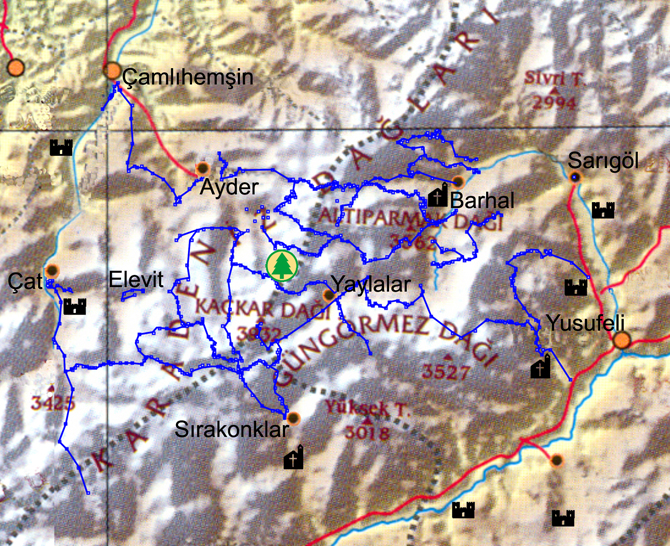 The Kaçkar book contains 8 long hiking trails, using different passes over the main range and ranging from 3-6 days long. Some can be done using local accommodation; for others you require a tent. You could use mule support on some trails. These trails link to each other in various places so can be combined to make longer trips. They are not waymarked, but you can mail us for GPS points. These trails start on inter-village paths often through steep, dense fir and pine forest, then rise to the treeline, which is at about 2100m. Above the treeline, they are easy to find. From the ridges and passes they have superb views over the ranges and valleys. Some routes link villages with high pastures; others are old trade routes; most are steep and some very rocky. All were researched, mapped and published by Kate Clow since 1992.
In addition, the guidebook has 7 waymarked daywalks in the Hevek valley, from Olgunlar to Barhal. These are intended as family walks that can be done early or late in the season, when the main trails over the passes are still closed by snow. Some of the pensions have leaflets with maps and walking notes for these trails.
The most popular trek is the climb of Mt Kaçkar at nearly 4000m. Lower daywalks and parts of routes are open for 5-6 months, but, unless you use snowshoes, summits and routes across high passes are only open July – September. You can hire mules and drivers to carry baggage for extended treks. There is accommodation in larger villages and plenty of water and many wild camp areas.
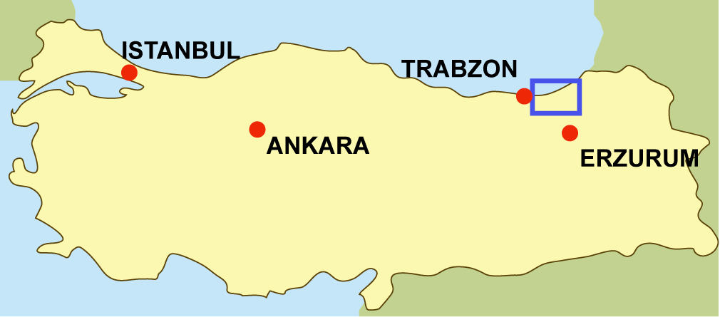
The routes on the south are reached from Erzurum, and on the north from Trabzon (both have main bus stations and airports); Artvin also has a major bus station. Daily public buses connect towns and villages.
Books, maps and GPS
So far, the only map is that available in the guidebook; an i-phone app will soon follow. Meanwhile, mail us for a file of GPS points, saying where you bought your guide book.
A series of free guides to the tourism features of Rize province were produced by Ersin Demirel with the sponsorship of the Governor. The subjects include historic bridges, glacier lakes, waterfalls, yaylas, etc.