
This 3-day route is a variation of the Lycian Way, but can also be used with the Lycian Way as a 4 day circular tour of Tahtalı. It runs through high level forest, mainly on mountain trails, passing Laodicia ancient site and passing through some magnificent scenery. It is suitable for strong walkers and the complete tour requires bivouac or camping equipment. It can be completed at almost any time of year, but in the height of summer walking should start at daybreak. In late winter expect some snow and maybe icy patches on the higher sections. Water is available at regular intervals and it is possible to camp overnight by water sources. Some of the camp sites are limited to only one or two tents at the moment – but more areas could be cleared.
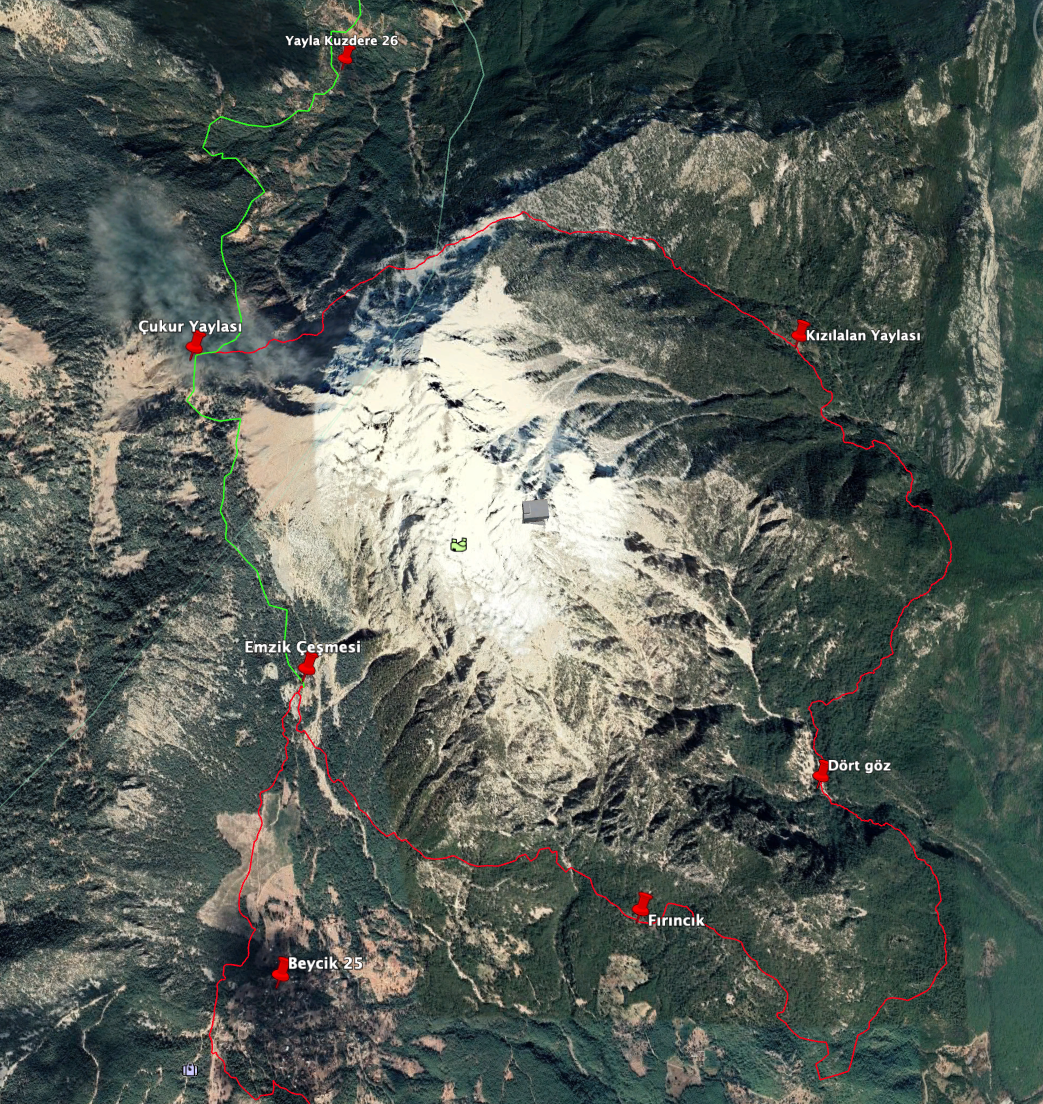
Road/track access to the route is available –
a) above Beycik on the forest road to Emzik Çeşmesi,
b) above Ak Boyun (the lower Mt Olympos teleferik station),
c) at Çukur Yayla to the N of Tahtalı.
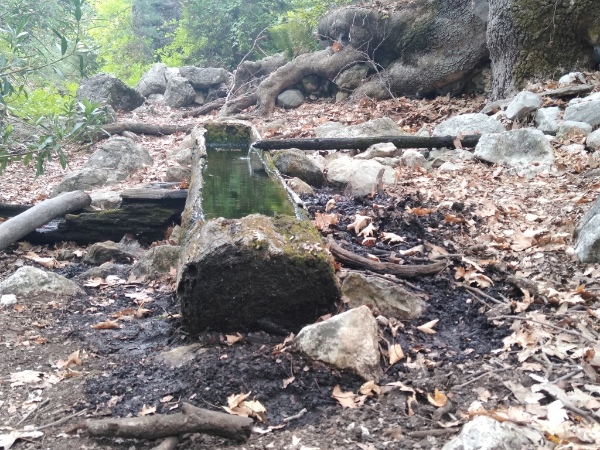
Good camping places are found at: Fırıncık Pınarı, Dört Göz, Kızılalan, Ahlatkızı Alanı, Çukur Yayla, Emzik Çeşmesi (which has a cafe/restaurant). The route leaves the Lycian Way at Lower Beycik, where there is a shop/market and Sami’s Cafe, which serves food. Sections are described accordingly.
Lower Beycik to Fırıncık, 3 hrs:
From a Lycian Way junction on the dirt track leading in to Lower Beycik, instead of turning L/up to follow the Lycian Way, continue level to meet the Beycik road just below a bend. Thereis a shop 200m below, and cafe just above this junction. Cross the road and continue below the villas; follow the marked path L/up and then NE across terraces, passing above a fire pool and into forest.Cross a wooded gully, then a dry stream bed; continue on more open land to meet a forest road on a bend. Follow it NE through forest then continue across scree, through forest and across a stream bed. At a junction a side trip the ancient ruined town of Laodikea is possible. 200m further on, by a meadow and plane trees, is the atmospheric Fırıncık pınarı (826m) with plenty of camp space.
Fırıncık to Dört Göz, 4½ hrs:
The path deteriorates and passes through bushy forest sections then beautiful yaylas as it approaches Kuzgun tepe (720m). A short side trip to the summit takes you to the remnants of ancient fortifications and a fine view-point. Now follow the the marked route going SE/down through forests to reach a path leading SE to Dört Göz (530m). This descends SE past 2 ancient farmsteads (2nd one by a fine viewpoint) and finally reaches the main path leading NE to Dört Göz (375m). The final section leading N to Dört Göz involves some traversing across steep ground above the river. Dört Göz has plentiful water and limited open areas for camping (515m).
Dört Göz to Kızılalan, 6 hrs:
Follow the river bed N for 200m, turn R and then climb through bushy forests to a stream bed (water). Here, turn NE/ right to climb to ancient terraces and house ruins. Soon after, find Baş Dere Çeşmesi (small camp area at spring). Now climb more steeply up through forest to a fine viewpoint on the R of the path, then continue less steeply to a more open, level pass (960m). The path now descends through forest with some undergrowth, then levels and continues to reach the main Ak Boyun to Kızılalan trail (830m). A marked path takes you down to a çeşme; a second çeşme is L/above the track, but more difficult to find. From the lower çeşme, a clear track takes you SE to the Teleferique station (20 mins).
Continue N then NW up the good trail to reach old graves (Gözlek Mezarlık 1035m). A few hundred metres further on are meadows at Kızılalan, offering a good camping area with a spring (Köy Pınarı).
Kızılalan to Ahlatkızı alanı and Çukur Yayla, 5 hrs:
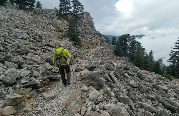
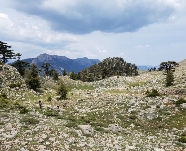
The path winds pleasantly NW/up through forests to meadows and clearing with a small shepherds hut, a çeşme and water troughs, making a pleasant camp site, (1370m). Continue up to an airy pass at Peynircik Tepesi, 1600m, then a gently traverse W/SW through meadows with fine views. Soon after a bouldery area there is a çeşme under cedar trees. The path continues with three crossings of steep gulleys, which require care, especially early in the season when the path over the gullies is not well trodden. The path continues and rises gently to meet the Lycian Way; keep L to Çukur Yayla where there are several huts and cultivated fields, possible campsites and water.
Çukur Yayla to Emzik Çeşmesi, 4½ hrs:
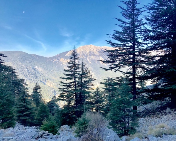
Follow the Lycian Way to beautiful woods then over a pass, 1815m, to the long descent S/down through cedar forests on a good path to Göl and Emzik Çeşmesi. Here there are campsites and a cafe, (1270m.)
Emzik Çeşmesi to Lower Beycik 3 hrs:
Keep S, across a scree path and rise into woods, then descend to an area of cut forest. On the far side, the path again enters forest and follows paths to a water depot above Beycik. Descend the road then turn R/S acros sfarmland and to a forested hilltop. On the far side, descend and cross a forestry road; a steep descent takes you to a bend on a tarmac road above Beycik; you could turn L here for accommodation and shops. The Lycian Way continues S, through forest on tracks, with a short section of forest road, to your strting point at Lower Beycik.
Alternative start – Emzik Çeşmesi to Fırıncık, 3 hrs:
Follow the dirt track down from Emzik Çeşmesi for 400m then take a path L/SW to reach the river bed. Cross the washouts to gain a beautiful path leading down to a forest road. Follow this past water and a fine viewpoint to its end. Now a good path leads to Laodikea necropolis and then on to Fırıncık.
Andrew Weilochowski


2 Comments
sadana
May 21, 2023
Great post, thanks for sharing. شركة نقل عفش بالرياض
Big black cock fuckswhite girl
September 15, 2023
Hi tto eery body, it’s my firsdt payy a quick visit of thiis webpage;
this website ccontains remarkable annd truly fne stuyff designed for visitors.
Write a comment: